Our series of posts related to exhibitions and events we’ve held this year continues, with quite possibility the most festive of the #geoadvent blogs to date….The Tectonics of the Cold War.
One of our exhibitions this year has revolved around the events of 1957 and the visit to the Geological Society of a delegation of geologists and geophysicists from the Soviet Union during the period of the Cold War.
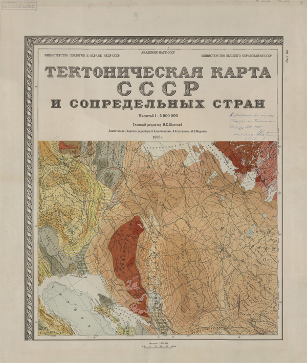
The title page of the Tectonic Map of Russia (1956). Nikolai Shatsky signed the map on the right-hand side when it was donated to the Geologial Society in 1957.
Josef Stalin had died in 1953. The subsequent power struggle within the Soviet Union saw Nikita Krushchev gain the upper hand having denounced Stalin’s cult of personality and freeze in relations with the West. A thaw between East and West began. One of the fruits of this shift was the International Geophysical Year of 1957/1958. It was timed to coincide with the peak of solar cycle 19 and expectations of heightened solar storms and geomagnetic activity.
Hopes for a shared and wondrous scientific future were raised, and the futurologists got busy imagining all sorts of amazing possibilities for things to come in light of the new spirit of co-operation. Exploration of Antarctica was to the fore with several nations send missions to the continent and the foundations of the Antarctic Treaty were laid down. The World Data Centers were set up to share research data and prevent loss of data in the event of war or other catastrophe.
The sun’s activity lived up to expectation with a solar storm in early 1958 causing a radio blackout across North America and casting aurora as far south as the line of 40°N. Earlier in 1956, another storm had led to a British submarine losing radio contact and triggered a search and rescue mission.

Vladimir V. Belousov
It was during this year of unprecedented hope and co-operation that a group of Soviet geologists and geophysicists headed by Vladimir V. Belousov did what would have been unthinkable even five years before. They went on a world tour. The reason for the tour was a map – the very first complete tectonic map of the Soviet Union completed in 1956 and published in 1957. It would have been the world of hundreds of cartographers and geologists throughout the country. Map-making was something of a Soviet speciality. They were the only major nation to have been teaching cartography to degree level since the early 20th century. Everything would have been done by hand from the surveying to the draughtsmanship to the publication. Not only were computers still rudimentary in the 1950s, not only was their application to map-making so poor as to be non-existent, but computer science (cybernetics in Russian) had been banned as bourgeois science under Stalin and there was no research in that area in the USSR.
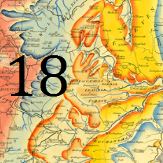
The map itself is at a scale of 1:5,000,000 and is split into 8 separate sheets. It is highly detailed throughout. Previous tectonic and structural maps had either been sketch maps or had covered smaller areas. To have such a map covering such a large area in such detail was a world first for the Soviets, and something of which they would have been very proud. They were touring the geological organisations and institutes of the world giving out copies of the map to demonstrate the pinnacle of Soviet geological science. It was towards the end of September 1957 that the world tour reached the Geological Society.

The Soviet delegation at the Geological Society, September 1957. Left to right: Mr Arthur Greig; Mr A J Butler, Secretary; Dr Gilbert Wilson; Dr V V Belousov; Dr N S Shatsky; Prof Leonard Hawkes, President (seated).
Vladimir V. Belousov and Nikolai Shatsky, the lead author of the map, met with President Leonard Hawkes, and senior members of the Society over drinks to present their gift. There would have been a lively debate about the map. Not only did it demonstrate the virtues of Soviet map-making, but it also encapsulated the structural theories of Doctor Belousov regarding how the Earth’s crust forms and moves. Throughout the 1950s debate surrounding this subject was gathering pace. Wegener’s theory of continental drift had been in circulation since the 1915. However, it wasn’t taken seriously by many geologists. There was a need for a huge amount of energy to make it happen and no obvious mechanism that would lead to the continents moving around the globe in a slow procession. There were some supporters, such as 1956 Wollaston Medal winner Arthur Holmes, who had devoted a chapter to Wegener’s theory in his major geological work ‘Principles of Physical Geology’
Belousov’s theory different greatly from that of continental drift. His studies had convinced him that movements in the crust were only vertical. Dense materials would sink to the bottom slowly over time while less dense, more buoyant materials would find their way to the surface. The bulk of the Soviet Union sat squarely in the centre of what we now know as the Eurasian plate. The Urals were situated firmly and unmovingly in the centre of the country, and there was little to no tectonic activity associated with them. How had they formed? Nothing was going sideways at all, only up and down. The map was evidence that any structural changes in the Earth’s surface could only possibly happen vertically. It was the first major set of evidence in what was to become an intense debate.
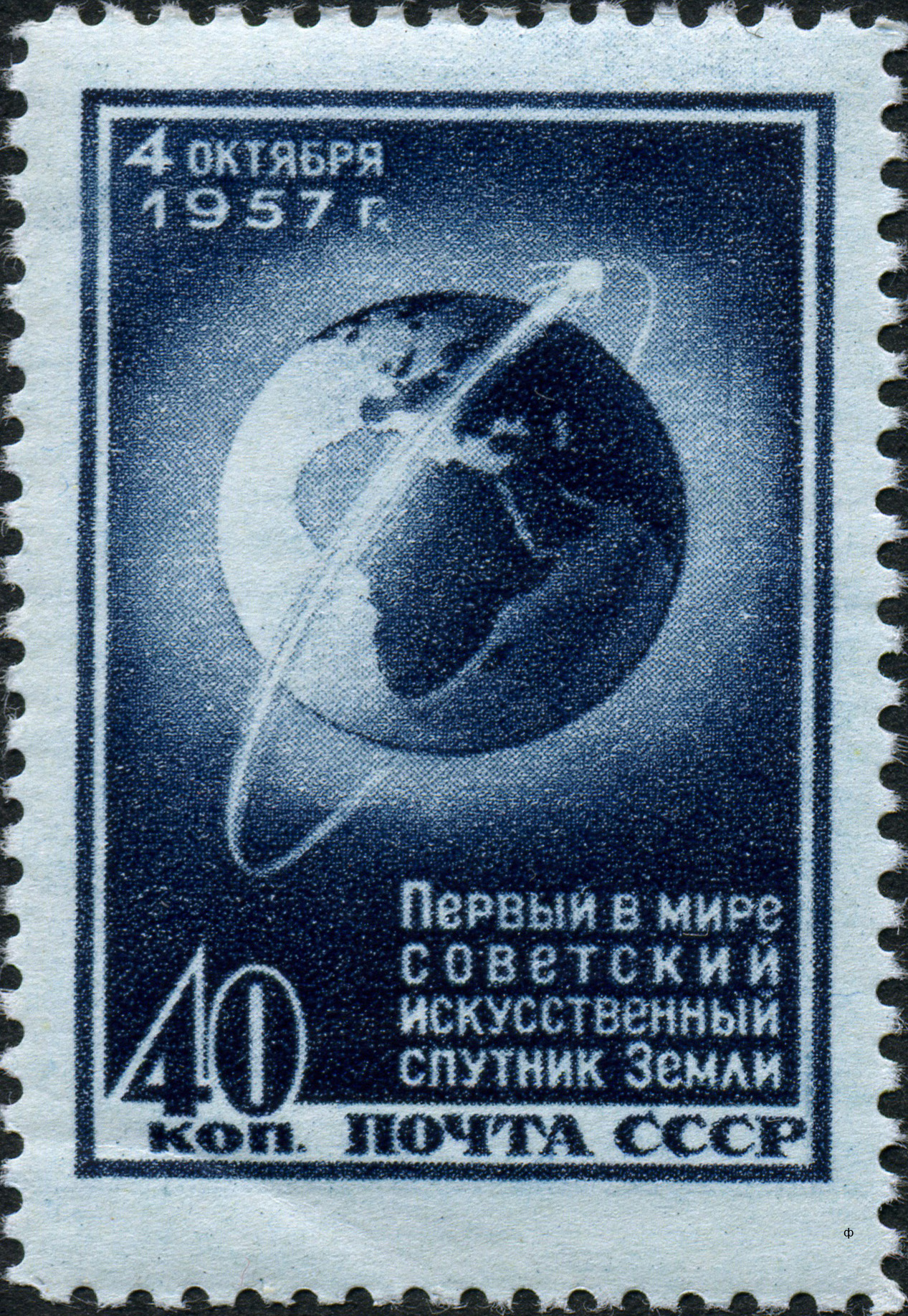
USSR Sputnik Stamp
After leaving London and the hospitality of the Geological Society another remarkable event happened. Whether Belousov knew of its immanence is doubtful, but it shocked the world none the less. On October 4th 1957, one week after Belousov and Shatsky met the President of the Geological Society, the Soviet Union launched Sputnik 1 into low Earth orbit and the world woke up in the Space Age. It was a piece of one-upmanship timed to coincide with International Geophysical Year. The USA had been intending to launch its own satellite later during the period and did manage to do so in February 1958 when Explorer 1 achieved orbit. By then Sputnik 2 had already joined it cousin in space.
All Sputnik 1 could do was transmit its radio signal back to Earth, but the possibilities that satellites offered weren’t lost on anyone. You could fit a camera on them, and quite apart from using them to spy on your enemies, you could use the data for remote-sensing of ground conditions and map-making. As the prohibitions on the Soviets developing computer technology were now lifted, they avidly collected geological data from around the world and made map after map. All detailed and with an accuracy that was unprecedented. We have a copy of their colour-standardisation cards for geological mapping from the 1960s in our collection. There are in excess of 50 cards with find gradations in colour and shading used to show all sorts of geologic and lithological data, all standardised across the whole of the Soviet empire. They were swimming in geological map data.
Unfortunately for the world and its dreams during International Geophysical Year, the thaw in the Cold War froze and froze hard with the Cuban Missile Crisis and Gary Powers being shot down while spying over the Soviet Union. Scientific collaboration was fractured along geopolitical boundaires once again. Belousov was now in charge of the Soviet geophysical effort and his theories held sway. With Krushchev out of favour, personality cults redeveloped and Belousov ensure that Soviet geology followed his ideas regarding the structure of the Earth’s crust.

Marie Tharp pretending to complete her map.
But on the other side of the Iron Curtain there had been other ideas and other maps produced. During the later stages of the International Geophysical Year, another map had been published, this time under the auspices of the Americans. Marie Tharp and Bruce Heezen had been using the data gathered by one-time pleasure yacht, the RV Vema, on the sea-floor of the Atlantic. Their first map was an idiosyncratic map with none of the fine colour gradations of Belousov’s. It was a ‘physiographic’ map of the ocean floor and harkened back to a much earlier style of geological representation. It did however embody what was to become an entirely new and different way of thinking about the Earth’s crust. It showed for the first time the Mid-Atlantic ridge and was one of the first pieces of evidence to support Wegener’s continental drift theory and it in turn lead to the development of plate tectonic theory. This was all Western science and in Russia Belousov held sway. His theories dominated Soviet geology until his retirement in the late 1970s. Only then could Soviet geology start to seriously develop plate tectonics and once again catch up with the West.
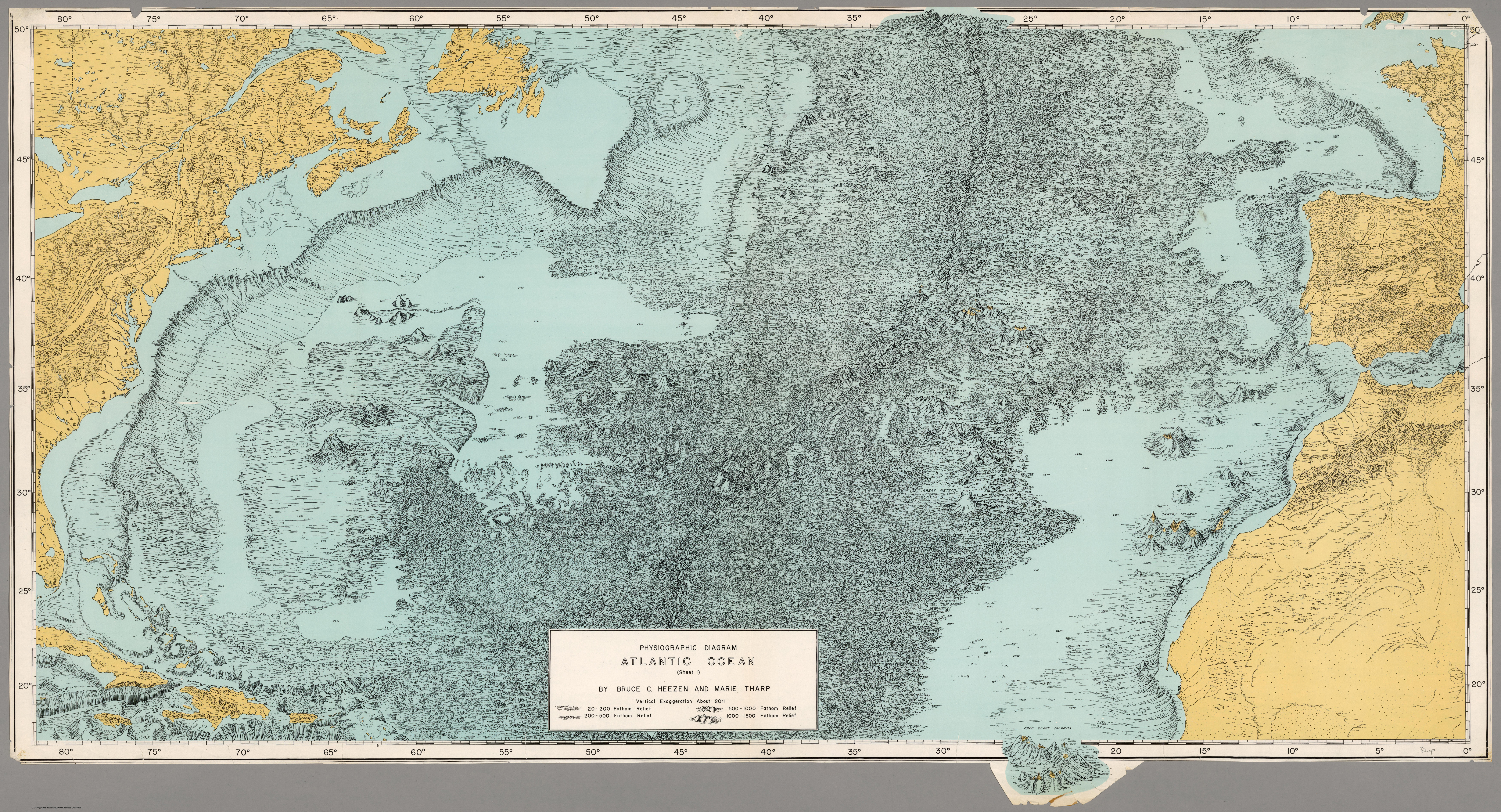
Physiographic Map of the Atlantic Ocean by Tharp and Heezen (1957)
The Society’s map collection still holds copies of both Belousov and Shatsky’s 1956 tectonic map as well as Tharp and Heezen’s physiographic diagram of the Atlantic Ocean from 1957, two pieces of cartographic history not only on the structure of the Earth’s crust, but also of the political tremors and tectonic shifts of the Cold War.
Previous posts from the exhibitions series:

Pingback: Door 20: Corrao-Hotham-Graham-Ferdinandea-Julia-Nerita-Sciacca Island (December) | Geological Society of London blog
Pingback: Door 24: Christmas greetings from the geoadvent blog team! | Geological Society of London blog